
Fall 2023 Week 5:
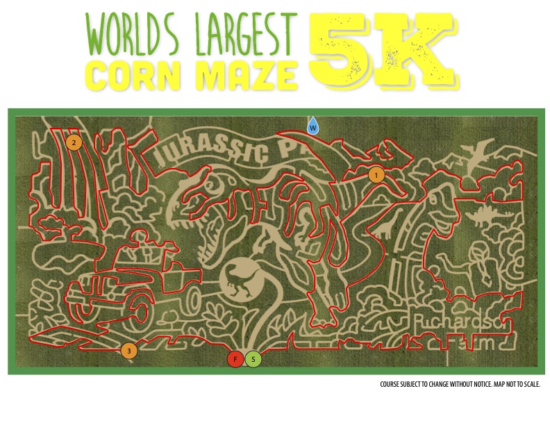
Good morning! I hope everyone’s morning is off to a great start! As we get closer to the beginning of October, farms across the state are opening up their Halloween events. One iconic element every year is the corn maze! Since Illinois produces so much corn. No one makes a better corn maze than the Richardson farm up in Northern Illinois. They design an intricate design and carve it out with tractors. It is so long that they annually run a 5k through the maze each October. This year’s design focuses on Jurassic Park as you can see in the image attached. Last year was James Bond themed, and in a previous year they paid tribute to the Apollo 11 moon landing. GIS is an essential technology in agriculture in which farmers can remotely sense the conditions of crops/soil using drones and then analyze them. These technologies can also be used to plan intricate designs in the landscape (landscape architecture) and this corn maze brings the two disciplines together. For the maze participant, mazes make you use your geographic skills to find your way through. We will be using those skills in our upcoming Urban Orienteering event next week. Until then enjoy your week and stay curious!
Fall 2023 Week 4:
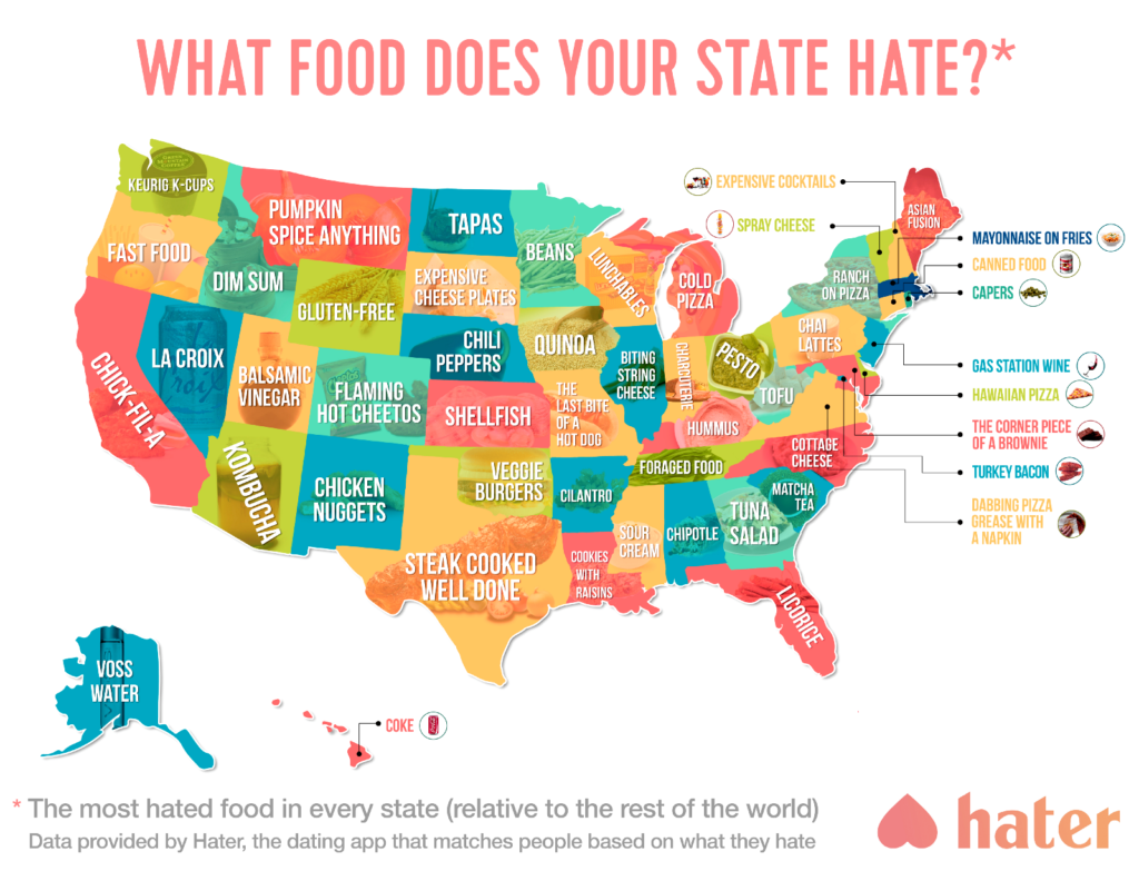
Happy Monday! This week’s map-of-the-week is one of my favorites that I somehow stumbled across a couple of years back. It is a map of what food each state in the US hates the most! From Louisiana disliking cookies with raisins to Colorado’s distaste for Flaming Hot Cheetos, the variation is dramatic. This map is sure to start a conversation among whatever group you show it to. Always fun and humorous. In some ways, it speaks to how food is a bridge between people and cultures. A place to come together to talk about something we as humans all share in common. Cartographically speaking, this is a very pleasing map to look at. The colors are well chosen where they are distinct enough, but also flow with one another. The addition of the images also balances the intensity from the colors. Today also marks the 22nd anniversary of the 9/11 terror attacks, please take a moment to remember. A reminder, we will be having an Intern Discussion Panel Event on Wednesday at 5:30pm in NHB 2049 to talk about internships, the application process, and GGIS careers in-general! Excited to see you there and hopefully you have a great week without any of these most hated foods!
Fall 2022 Week 5

For our map of the week 5, we flip the scales going from small to large by looking at a basketball court. Basketball like many other sports has a unique history and has spread across the world. This map by Ben Hur is a range map used to analyze the University Athletics Association of the Philippines 81st Basketball Season. The hexagon size indicates the number of field goal attempts while the color shows the number of points scored per attempt. Cartographically, note the unique use of the hexagonal shape which is interesting and at times hard to properly incorporate into a map design. Furthermore the dark background color scheme helps to make the other colors pop for the reader.
Fall 2022 Week 4
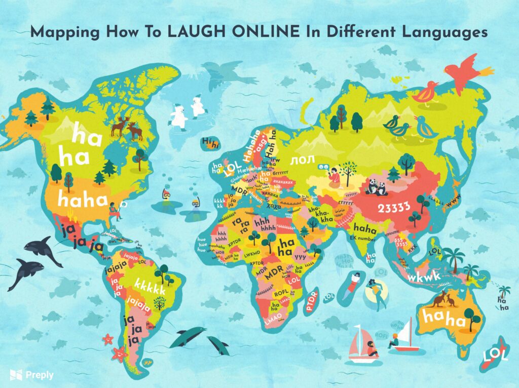
Our first map of the week explores language, and specifically online laughter across the globe. Language is one element that varies greatly from place to place influenced both by physical and human boundaries. The internet is thought of as a way to bridge these divides across space, but divisions have thus formed in our online discourse from culture to culture, and country to country as represented in this map. From Malaysia with “Ha3” (an abbreviation of hahaha since you say ha 3 times) to “ahahah” in Italy (since Italians don’t have a strong ha sound), each language finds a way (or multiple ways) to express this human phenomenon in a unique way. Looking at the map’s cartographic design, it is rather playful yet not too busy where the information in conveyed quite well and it draws the viewer in. You can learn more about each online laugh here: https://preply.com/en/d/laughing-around-the-world-map–lp.